purplecat: Hand Drawn picture of a Toy Cat (Default)
We had a "free" day in Cusco, but there were some suggestions of activities that our guide could organise for us. Two other people in the group were interested in seeing the Moray Ruins and the Salt Mines of Maras and we were happy to tag along and make the excursion cheaper.

Moray was the first Inca Plant laboratory we encountered. As noted previously, it wasn't quite clear to us why it earned the status of laboratory.

ExpandPictures under the Cut )

The Salt Mines are not actually mines, but a salt extraction plant that predates the arrival of the Spanish and which are still worked today. Mineral rich water from the mountains comes in and fills clay lined pools. The water then evaporates and the salt is collected. They are owned by 300 families and there were people working them - flattening the clay lining - when we visited. I bought salt.

ExpandPhotos under the Cut )
purplecat: Two dummies wearing Edwardian dresses. (General:History)
Sacsayhuaman is a massive Inca fortress, called the House of the Sun, on a hill top above Cusco. We were taken up their on our first day in Peru, walked around the site and then walked back down into Cusco.

ExpandIt is quite a thing )
purplecat: Hand Drawn picture of a Toy Cat (Default)
Our Inca Trail holiday actually started with three days spent in and around Cusco, the ancient Inca Capital. Our first day started with a walking tour of Cusco. Because of the various mix-ups with permits, this was with a guide called Arturo who should have been our guide for the whole trip, but wasn't.

ExpandPhotos under the Cut )
purplecat: The family on top of Pen Y Fan (General:Walking)
Then Wilbert showed us around Machu Picchu.

ExpandPhotos )

The story of Machu Picchu, as Wilbert told it to us, was that it was under construction as a district capital when the Spanish arrived. Intimating that things were going badly with the Spanish, the Inca moved 700 people and all their gold from their capital of Cusco along the Inca trail to Machu Picchu, destroying the roads behind them with landslides. They remained there for 80 years but were aware that the Spanish, in search of the gold, were getting closer aided by a generation of half-Peruvian, half-Spanish collaborators. After 80 years, therefore, they hid the gold in the surrounding hills and some moved back towards Cusco where they were captured by the Spanish and others moved east into the Amazon where their descendents were briefly encountered by archeologists in the 1970s. The Spanish eventually reached Machu Picchu but found no gold. This story does not appear anywhere else I've looked (but, as noted, information at the level of detail I'm accustomed to for historic sites is much harder to find for Machu Picchu), but it wouldn't surprise me if it isn't the legend as told among the local Andean people.
purplecat: The family on top of Pen Y Fan (General:Walking)
Day 4 started at 3:30am in the morning because we were supposed to meet up with the rest of our party at 11am at Machu Picchu which was about 14km away. Most of the rest of the camp got up and set out around the same time for reasons that were less clear to me - maybe the general plan is to get to Machu Picchu before lunch and then spend the afternoon in the city.

Anyway, this meant the first hour of the walk was in the dark going down steep steps with head torches which, once the novelty had worn off, wasn't much fun. We were, presumably, missing some stunning views.

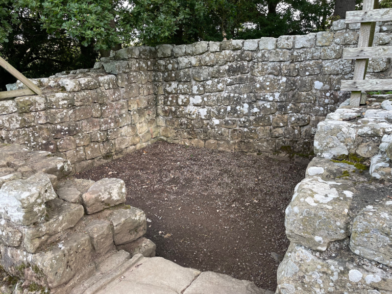
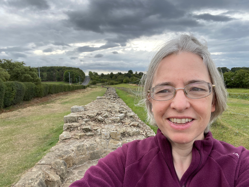
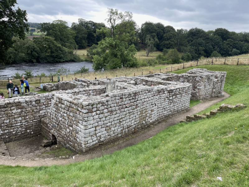
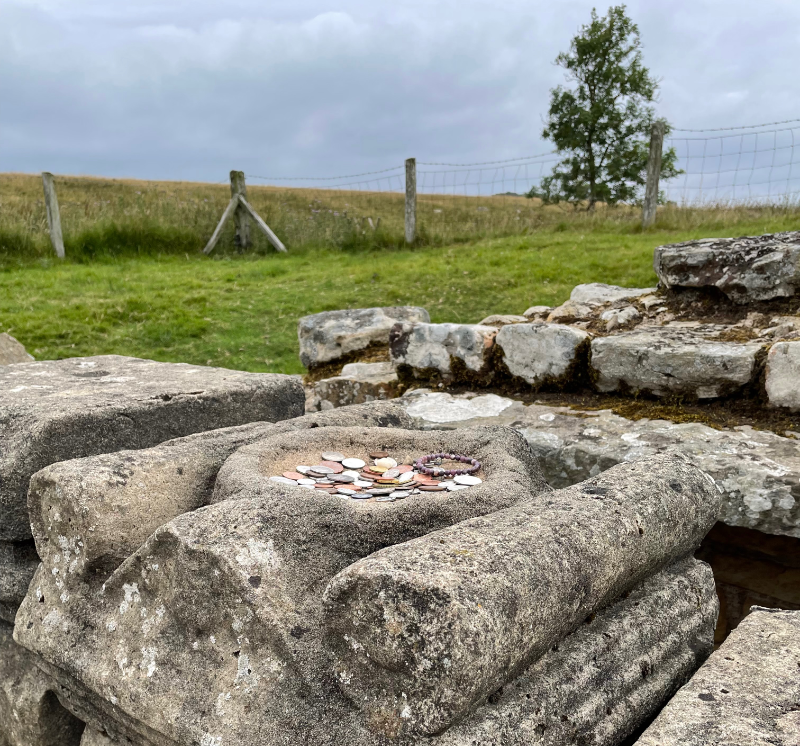
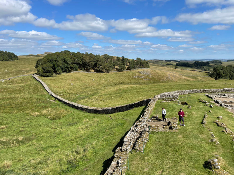
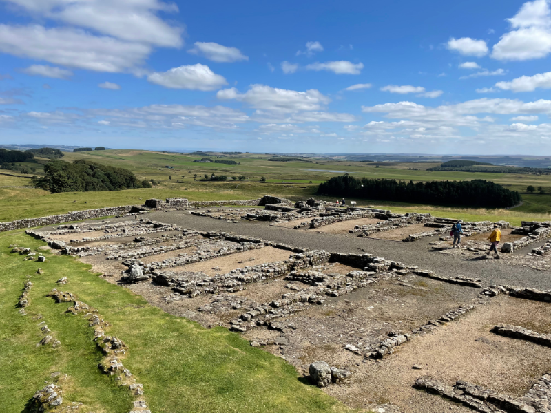
The first ruin of the day was Intipata. This involved a slight diversion off the Inca road itself. According to Wilbert no one had even known it was there until a forest fire about 25 years ago. It's a bit difficult to convey it in photographs, especially as we don't seem to have managed to take any which have any people in for a sense of scale. It was huge, each individual terrace rising above our heads. As far as one can tell, it was a farm.

ExpandPhotos under the cut )

We then went to 
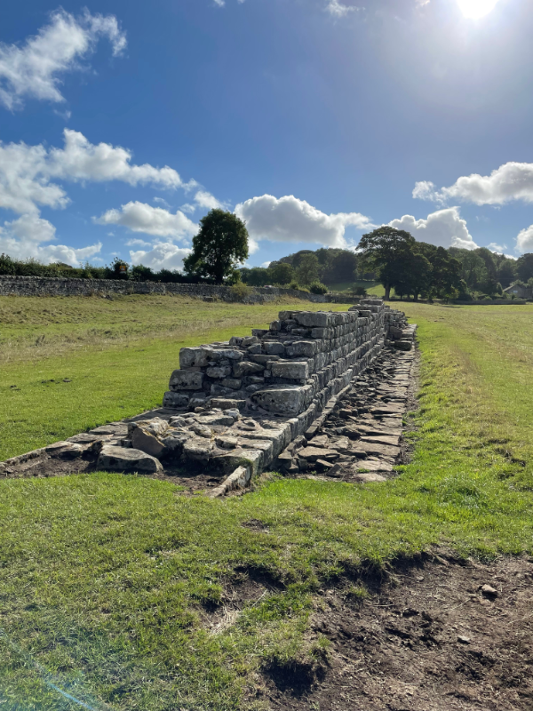
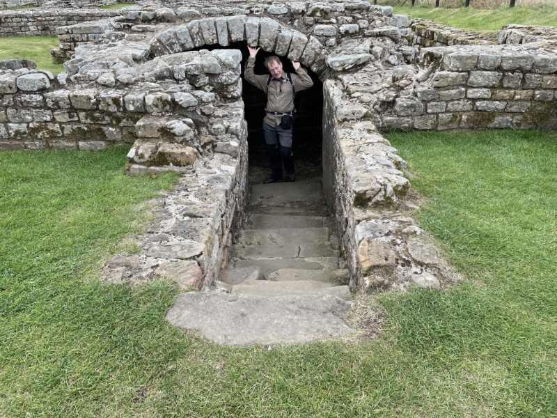
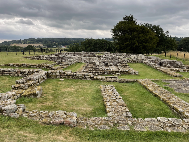
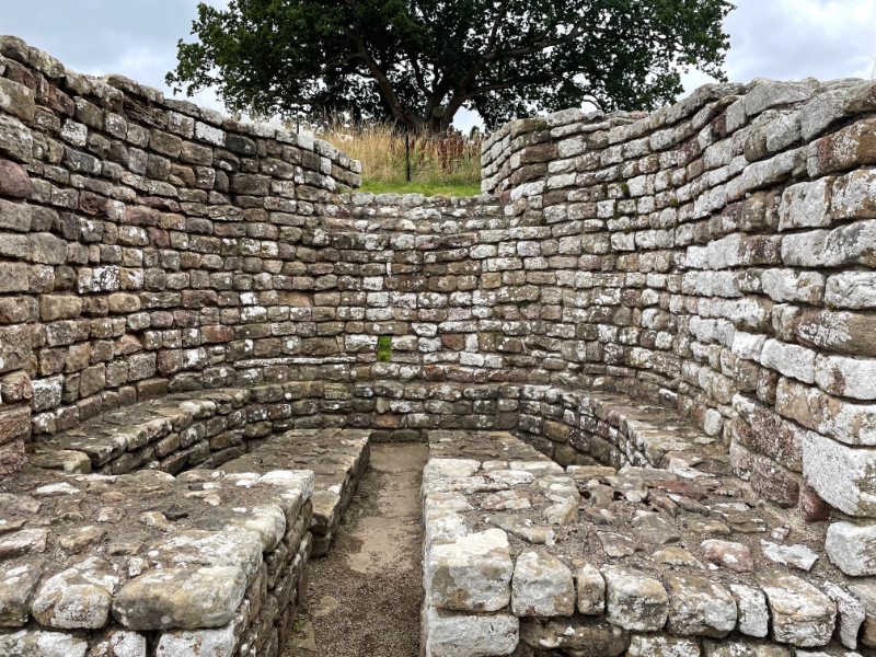
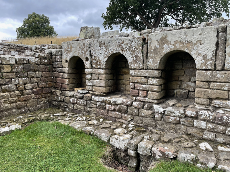
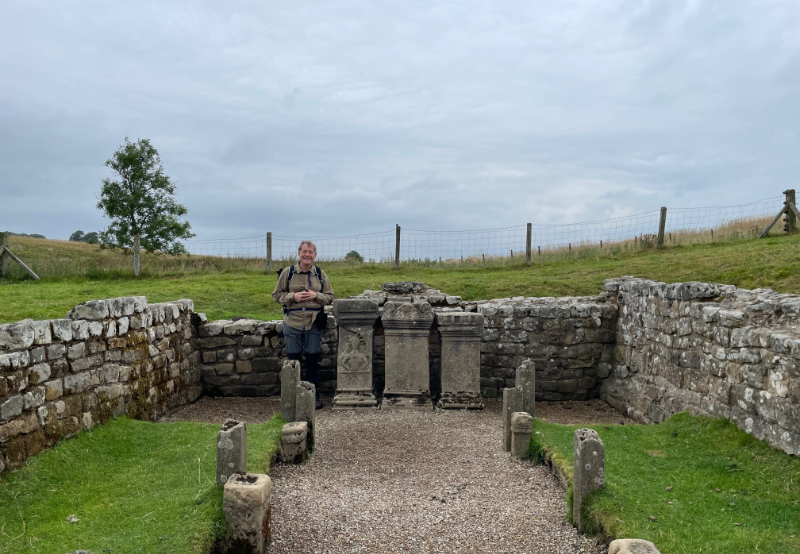
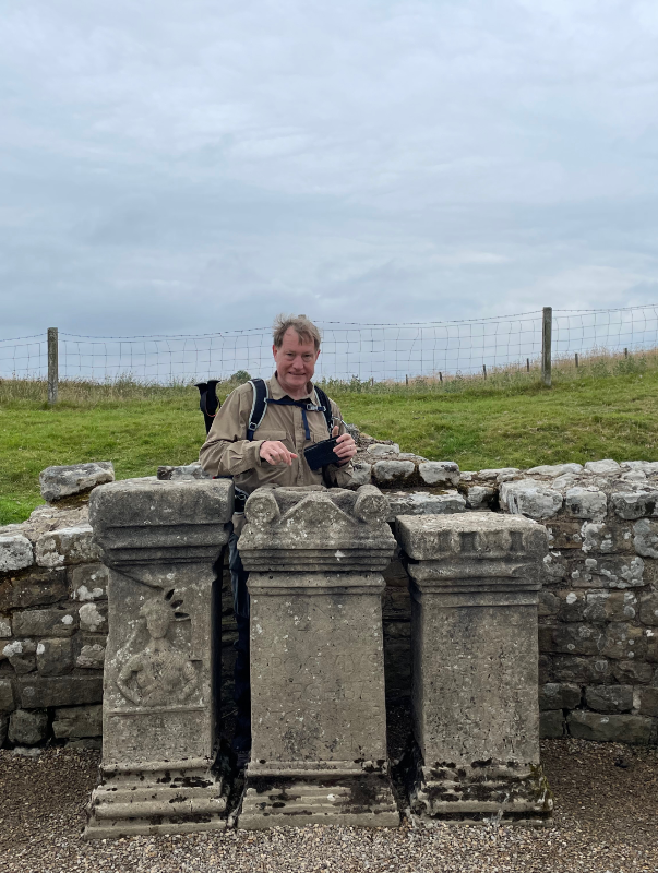
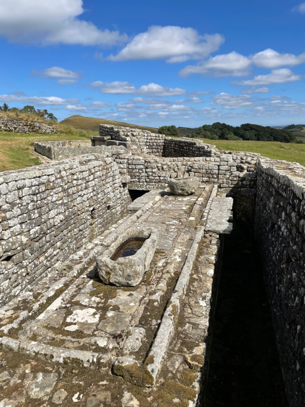
Wiñay Wayna which was very similar except that Wilbert insisted it was a laboratory not a farm. We had previously seen another Inca "Laboratory" at Moray but were somewhat confused by the distinction. Laboratories, we were told, were convex while farms were concave. The convex shape caused microclimates at each terrace and you could see different plants were grown on each terrace so it was obvious that the Inca's were experimenting. B. and I felt a frew crucial steps were missing here for something to be called an experiment, as opposed to growing things where they grow best. I was actually getting rather tired at this point so I just sat down and admired the view at Wiñay Wayna, while B. walked down to look at the buildings disturbing some Llamas who were grazing on the terraces.

ExpandMore Photos )

Wiñay Wayna was right by a campsite of the same name. It was currently out of use following landslides but was, apparently, where people normally spent the final night on the trail. Having left us to explore Wiñay Wayna, Wilbert sat down and chatted to the various guides and porters working at the camp. When we got back he reported that several other parties had gone past, none going to look at the ruins... which again seemed rather odd. I guess for a lot of poeple the Inca Trail is about the walk and then Machu Picchu and not so much about the less well known ruins along the way.

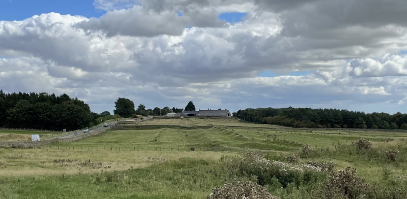
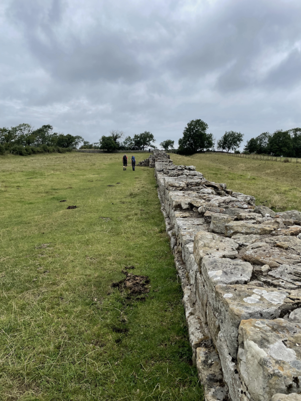
Once past Wiñay Wayna, we left the controlled part of the Inca Trail. At that point I half expected to start seeing day trippers up from Machu Picchu but we never passed anyone going the other way. Wilbert said this was because day trippers were lazy (Wilbert considered many people lazy, including anyone who spoke Spanish in preference to Quechua) but I would have thought quite a lot of people would like to walk along a bit of an Inca road without necessarily doing so for four days and going over Dead Woman's Pass.

Anyway, we continued for another 5 or so km, mostly on the flat but rising slightly until we came to a set of steps that Wilbert cheerfully informed us were called the "Gringo Killer". He had my measure by now and offered to take my sticks while I clambered up.
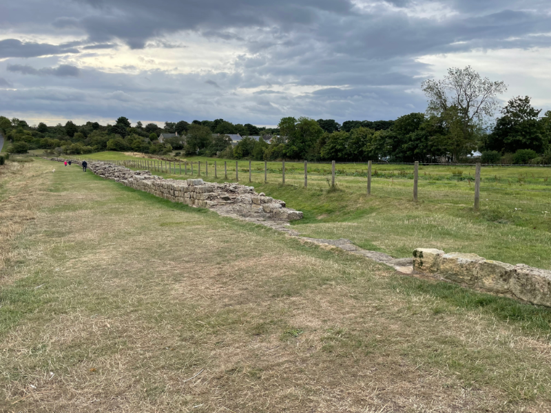
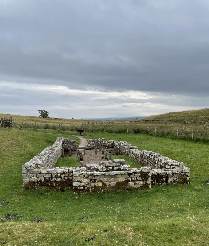
ExpandEvidence under the Cut )

Then we turned a corner and came out at 
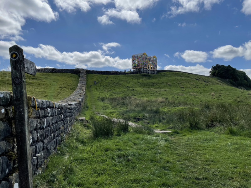
Inti Punku, the Sun Gate, the ceremonial entrance to Machu Picchu. This is where you get your first glimpse of the city.

ExpandPhotos )

I'll leave Machu Picchu to another post. We were half an hour "late", but Wilbert had a back-up plan which involved showing us around himself and we bumped into the rest of the party during the tour. I was a little frazzled when we got there - a combination I think of the early start, a fairly long walk and the fact my esim wasn't working so I was out of WhatsApp contact from our other guide and so couldn't coordinate meeting up (I eventually managed to contact him via B's phone). But once I'd sent the WhatsApp message and had something to eat, I cheered up enough to enjoy the city.

I felt even better after a bus ride down to Aguas Calientes and a late lunch.

ExpandEvidence of Lunch )
purplecat: The family on top of Pen Y Fan (General:Walking)
Unlike Day 2, which was hard work and not terribly rewarding, we loved Day 3 on the Inca Trail. Once again we set off almost as soon as it was light. Wilbert's plan was again to have all the walking done before lunch, in part because of convenience, but this time he also knew there were a lot of ruins to see and was quite keen to get us to them before everyone else got there. In this he was successful. We generally got to look around ruins on our own, but a big group would arrive just as we were leaving.

The first of these was Runkuraqay which Wilbert described as a fuel station for people, which we interpreted as meaning an Inn.

ExpandRunkuraqay Pictures )

We then went up and over a pass, a little lower than Dead Woman's Pass the previous day, and a shorter climb because we'd started higher. Then we came down towards Sayacmarca, a much larger ruin.

ExpandPictures )

Once we left Sayacmarca we continued down to about 3,500m. After that the trail was much more level. Strava shows a steady climb, but I felt much more able to look about me at the scenery rather than paying close attention to where I was putting my feet. As the trail levelled out we got to Qunchamarka, another Inn. It wasn't clear how to access this, but we walked around the outside. I think at this point we were up in a Cloud Forest - though I'm hazy on the difference between Cloud Forest, Rainforest and regular forest, all of which I think we walked through at various points.

ExpandPictures )

Wilbert spent some time telling us about the Inca Tunnel we would meet. B was pretty sure this was just a large fallen rock which the Inca's had run the path under. Wilbert got distracted at this point since he found a dog in the brush above the tunnel. After some encouragement he got it to climb down and it ran off down the path ahead of us. We met it again at the next campsite where, presumably, it belonged. I'm afraid we failed to photograph the dog, so you'll just have to imagine it.

ExpandB did photograph the tunnel, however )

We arrived at our campsite in good time for lunch. The camp was above another Inca ruin, Phuyupatamaca, and after lunch Wilbert packed us off to take a look at it on our own. This involved going down some steep steps and it seemed like the water source for the camp was at the bottom, because we were passed by a lot of porters carrying water back up them. At the time we assumed he sent us to look at it then, rather than the next day, because the plan was to leave before light so that we would get to Machu Picchu in time to meet up with the rest of our group. However it transpired that pretty much everyone was leaving before light and we seemed to be the only party who's guide thought to encourage us to check out the ruins we would miss in the dark.

ExpandPictures of Phuyupatamarca )

We had an excellent position in the camp right next to a large rock that overlooked the view. We were next to the camp of a group of three people who were on the "Luxury" tour. Wilbert was very contemptuous - they had three guides and a masseuse. They were also served cocktails in glasses made of glass when they reached camp. The most disconcerting thing was that they were played into camp by Andean pipes. B felt he would have been quite happy with the cocktails and the larger tents (including a shower tent!) and so on, but felt he wouldn't have coped with the pipes.

ExpandPictures in the Camp )
purplecat: The family on top of Pen Y Fan (General:Walking)
Day 2 on the Inca Trail was the least fun of the trip. We had to climb 1,200m to get up and over "Dead Woman's Pass". Wilbert, our guide's plan was to get going as soon as it was light (around 5:30am) and aim to reach our campsite at lunch time. His reasoning was to get most of the actual climbing done while we were in the shadow of the tall mountains around us. It also made life simpler for the support team who wouldn't have to pick somewhere en route, unpack to make lunch, and then pack up again to get to the campsite. He also, I think, quite liked the idea of catching up with the group that were ahead of us who were starting around 700m up the climb and who would be having lunch at our evening campsite. In the event we arrived at our campsite about 2 hours after they had left, having another pass to go over before they got to their campsite for the night.

We were on modern trails, according to Wilbert, and although I think we passed some Inca ruins at a campsite en route, we didn't look at them. Wilbert's explanation for the route wasn't entirely clear. As I understood it the original Inca road went over a different pass, though I never figured out if it was higher or lower. I got the impression a large section of the road from Cusco to Machu Picchu was destroyed by the Inca themselves, triggering landslides, in order to prevent the Spanish finding their way along it, so maybe that explains why we were following a modern alternative.

We started at about 3000m. At around 3,700m I began to feel quite tired and a little concerned about the 500m still go. At 3,900m as we came out of the shade and into the sun, my legs felt like lead and I made it up to the pass only by doggedly walking 300 steps and then stopping (300 steps, if you are interested, gets you up about 50m). At the time we put this down to the fact Manchester is super-flat and so our uphill muscles don't get a lot of exercise. However, I wasn't remotely stiff the next day, at which point it occured to us to measure my blood oxygen using my watch. It was down at 81%, rising to 88% if I took several deep breaths (B., in contrast was generally in the high 80s/low 90s). So it's possible the issue was lack of blood oxygen - even though I wasn't showing any other symptoms of altitude sickness.

Once over the pass we descended around 600m to our campsite. I badly wanted to go to sleep, but B. and Wilbert forced me to have some lunch first. Then I slept for an hour, after which I felt much more like myself.

We walked a total distance of just under 12km.

ExpandPictures under the Cut )
purplecat: The family on top of Pen Y Fan (General:Walking)
We did our Inca Trail holiday with Explore! who (out of necessity as I understand it) subcontracted to a local tour company. At some point something went wrong with getting permits for the trail. The story we were told was that the local agent forgot to apply for our permits, but several other people in the group had had permits delayed, so we concluded that there had been a more general permit mix-up which was simplified for our consumption as "forgot to apply for your permits". The up-shot of all this was that instead of travelling as part of a group of ten walkers with a guide, cook and porters it was just the two of us with a guide, cook and porters, setting out a day after everyone else with the aim of catching up with them at Machu Picchu. This was a mixed blessing, we got a lot more time with our guide and didn't have to worry that we were slowing anyone down, on the other hand it felt like an awful lot of staff for just us and even though our guide as very good at leaving us alone for various stretches, or sending us off on our own to explore things, it was quite intense.

ExpandPhotos and more under the cut! )

Hobbiton

May. 19th, 2024 03:30 pm
purplecat: Gandalf driving through the Shire (Tolkien)

A view over Hobbiton showing rowing hills with round doors in them.  In the foreground is a market garden with pumpkins.


So, yes, on the Sunday in New Zealand I went to Hobbiton. In fact I took a guided minibus trip that also included some caves with glow-worms in them which, while pretty, didn't quite live up to the hype and wouldn't allow photos.

I wasn't quite sure what to expect at Hobbiton - it is a movie set after all, but actually - as both the guide on the minibus and the one he handed us over to once we got there explained - the set used for Lord of the Rings had been completely removed at the end of filming. However, over the subsequent years the farm started making a lot of money from driving fans up to the empty field where the set had been, so when The Hobbit movies came round they proposed that the film build everything for real and then operate it in an ongoing fashion as a tourist attraction. This is what is there today and it's pretty impressive. You can't go in to most of the hobbit holes, but I gathered they all had an actual room behind the door (mostly used for storage).

To be honest, I have a lot of photos of misc hobbit holes so I've bunged them all into the directory which I use for random Friday pictures, so you can see them as they pop out amid all the castles, fossils and random neolithic stones. Even so, and with some strategic weeding, there are a lot of photos.

ExpandYou have been warned! )
purplecat: An open book with a quill pen and a lamp. (General:Academia)
If you had noticed I was posting at odd times last week it was because I was in Auckland, New Zealand at the AAMAS 2024 conference. The conference started on Monday but I arrived in the early hours of Saturday morning and then had to contrive to stay awake until at least early evening. Thankfully the hotel let me into my room early so I was able to wash, change my clothes, faff around on email, spin pokestops and post Granny's Diary but by the afternoon I felt a change of scene would be needed. I googled things to do in Auckland and realised I could see an extinct volcano from my hotel room window. So I climbed it.


A pronounced grass covered dip in a hill top.  Beyond the Auckland skyline is visible, including a slender circular tower that tapers to a point.


It wasn't, honestly, that hard to get up being in the middle of a park. Information boards informed me that it was surrounded by earthworks from early Maori settlements though, to be honest, I found these hard to pick out. I think their effect was obscured by the raised boardwalks that surrounded the volcanic crater, set above the earthworks to prevent people walking on them. The crater, itself, was off limits. According to the information boards it was sacred to Mataaho, the god of things hidden in the ground and was known as Te Ipu Kai a Mataaho (the Food Bowl of Mataaho).

Those with a good knowledge of geek geography can probably guess where I went the next day, but there are a lot of photos that need sorting...

Wroxeter

Sep. 17th, 2023 02:02 pm
purplecat: Averbury Stone Circle.  A large stone close by and smaller markers leading away. (General:Prehistory)

View of low stone ruins with an upright wall on the right and a Roman down house with a colonnade and yellow upper storey beyond.


The village of Wroxeter occupies one corner of the Roman city of Viroconium Cornoviorum. English Heritage has preserved an excavation of the substantial baths, next to a modern recreation of a Roman town house. Most of the baths, as is common with Roman remains, had clearly been covered by the landscape but "The Old Work" must have stood visible in arable land and one can't help feeling that the nearby residents of Shrewsbury missed a trick when they didn't loot it for building material.

ExpandPictures under the Cut )
purplecat: Hand Drawn picture of a Toy Cat (Default)
We walked along the Montgomery Canal twice during our holiday - once going north from Welshpool and once south.

ExpandPictures under the Cut )
purplecat: The family on top of Pen Y Fan (General:Walking)
"Bring your outdoorsy clothes we might get lucky with the weather," Matryoshka said in one of her emails before this trip.

I therefore packed my walking boots. I considered packing my walking sticks but wasn't convinced they were worth the trouble of trying to get into the carry on luggage. Once here, we consulted the weather and decided that Tuesday was the best day for a walk. Matryoshka then picked us a 13km (allegedly) walk to the next town, past a Vikinghytten where she promised there would be waffles. I murmured a bit about the lack of walking sticks but she insisted we would take the funicular railway up to the plateau and, once up there, "it's very flat". It was only later it occurred to me that, being nearly 10 years younger than I am, she might not have realised I value my sticks more on the down than on the up.

Anyway we got up onto the plateau where the walking was pleasant and easy albeit with a bit more up than Matryoshka had anticipated.


A square cairn with a pointed stone on the top and a sign.  Beyond it is visible a blue wooden house.
Despite the fact the sign on that cairn reads Vikinghytten, that house is not the Vikinghytten. When we got to the Vikinghytten which was actually off to the left of that cairn, it was resolutely shut and there were no waffles to be seen. Also, the toilets were locked.

However we continued onwards and upwards a bit following a nicely visible line of cairns. Then we took a turn off this path and things became a bit more complicated. It's a long time since I've been on a walk without the combination of solid GPS and an ordnance survey map. I had managed to persuade Matryoshka to load the route to Indre Arna, on her phone and we relied on this quite heavily in what followed as the path repeatedly disappeared leaving us to strike out in roughly the right direction across the bog until we picked it up again.

Then we hit the down which was both muddy and steep and variably pathless, sufficiently so that when we came out on the road and then missed the turning back onto the path we decided to stick with the road which only took us a little out of our way. Shortcuts make long delays, we reassured ourselves, and we were certainly travelling about twice as fast on the road as we had been on the path.


image showing a contour map with two peaks, then sharp down from about 9km to about 11km which subsequently flattens out about.  Over this is a blue line which shown a noisy track but generally downward trend until there is a sharp dip just after 10km after which it rise up higher than the start.
This is the Strava analysis of the walk showing elevation against our pace. The point where we hit the road is fairly obvious.


We ended the walk in a very empty but very clean train station with a very space age toilet but no bar. We waited 30 minutes for a train and 10 minutes later we were back in Bergen, where we went our separate ways, showered and then met up again for burgers and beer. We were both clearly a bit dehydrated when we compared notes this morning, but neither was too stiff though Matryoshka had sore ankles and I have slight numbness in one big toe.


View from the plateau, down to the pine forest and then to the fjord.


Allegedly this was a research meeting and, to be fair, we did plan out a textbook though we got side-tracked today into writing a paper so the textbook plan hasn't even made it as far as an outline document.
purplecat: Satirical take on the famous stick person illustration of the Trolley problem.  Lots of trolleys, lots of tracks, lots of people tied to them,  lots of switches. (General:Ethics)
The talk went well though, as I had somewhat expected, at least two other people in the audience had worked on formalising traffic rules and done so rather more thoroughly than we had. Still, now I have papers to read.

In the afternoon we had breakout sessions, so I got to spend a couple of hours arguing about what normative competence(s) might be, pausing only briefly to eat cake because, it transpires, you can eat cake and argue about normative competence at the same time (even though, as some of us pointed out, while eating cake one has permission to discuss topics other than those of the seminar). Tomorrow I might switch to the group that is arguing about what an explanation is.
purplecat: Satirical take on the famous stick person illustration of the Trolley problem.  Lots of trolleys, lots of tracks, lots of people tied to them,  lots of switches. (General:Ethics)
Today was full of talks. The theme of the workshop is Normative Reasoning for AI, but some of the talks seemed more like logic (or theorem proving) theory talks - perhaps that is a natural consequence of mixing communities. I'm talking tomorrow morning on the UK Highway Code - I do so because the organiser suggested it, but he's now denying responsibility and says he's happy for me to talk about verifying machine ethics if I want to. This is tempting. I have a much more solid body of work on machine ethics than I do on the Highway Code. On the other hand the Highway Code talk is now written and cheese is being served in 10 minutes - so if I start writing a talk on machine ethics I will miss out on cheese. There are gaps in the schedule, so I will tell the room tomorrow morning that I could give a "lightening talk" on machine ethics if they really want one, and then the assembled worthies can decide.
purplecat: An open book with a quill pen and a lamp. (General:Academia)
I'm at a Dagstuhl about which I have written before though I have also attended Dagstuhl's I have not documented (or at least not documented under the tag travel:work related).

Covid precautionary arrangements seem a little uncertain. However the Schloss website suggests masking whenever we move around, so I have an FP95 with me, though presumably we will be taking them off for shared meal times, so I'm not clear how effective they will be.

The Dagstuhl hasn't actually started yet, but it's 6pm which means dinner will have just been served per the ruthless Dagstuhl timetable, so I had better go and see what it is.
purplecat: Averbury Stone Circle.  A large stone close by and smaller markers leading away. (General:Prehistory)
On our final day we walked from Chollerford to Heddon-on-the-Wall. There wasn't a great deal of wall left to be seen now we had come down from the hillier parts.


Stretch of wall alongside a path that goes under trees.

The remains of a square turret.
This was our last turret - just after Chollerford. It's more exciting when you are coming in the other direction and it is your first turret.

A low stretch of Hadrian\'s Wall in a field.

View of a field with undulating ridges showing where ditch and vallum were.
Although there is no wall visible here - the ditch and vallum have left their mark on the landscape visible even after 1900 years.


We got to Heddon-on-the-Wall in good time to meet [personal profile] sir_guinglain for dinner in a pub. We didn't actually visit the wall at Heddon until the next morning.


Longish stretch of low wall next to a fence.

Selfie showing the wall next to a fence behind me.

Then we went home.
purplecat: Averbury Stone Circle.  A large stone close by and smaller markers leading away. (General:Prehistory)
Chesters is probably the most impressive of the Hadrian's Wall forts simply because it has walls that are in many places a good deal higher than the foot or so you see elsewhere.


B peering out from under a stone are.  Stone steps lead down to it between walls.
A store room.

Low walls showing rectangular rooms.

B standing in the entrance to a square building.  It has no roof but the walls reach up above his head.


The bath house complex by the river is particularly impressive.

A semi-circular room with high walls and stone benches around the edge.
I think this is the hot steam room - presumably a bit like a sauna.

A stone wall with small arched openings.
These were the lockers where you put your clothes before entering the complex.

Looking down on roofless stone walled buildings leading down to the river.
purplecat: Averbury Stone Circle.  A large stone close by and smaller markers leading away. (General:Prehistory)
Day 5 was a ridiculously short walk. The intention had been to take a side-walk down to Corbridge as part of the day's walking, but I'd made a mistake and the side-walk left the main path close to Heddon-on-the-Wall (at the end of the Day 6 planned walk) not close to Chollerford (the end of the Day 5 walk). In the event therefore, even taking things slowly we were in Chollerford by lunch time.


Straight and flat stretch of Hadrians Wall


One of the places we lingered - or at least lingered as much as one can really, when viewing a stone building in a field, was a Temple to Mithras close to our B&B at the start of the day.

Rectangular low walls.  At the far side a pathway leads in at an entrance.  Small stone markers form an aisle down the centre of the building.
Top of a stone altar with pennies and a small bracelet left in it.
B. stands next to three upright stones at the end of the building.
All the carved stones were, in fact, reproductions. The originals were in the museum at Chester fort.
B. behind the three large stones at the end looking as if he's about to nick something from the altar.


Once we got to Chollerford and deposited our back-packs at the hotel where we had upgraded our room to a luxury suite - largely because they offered such an upgrade as part of some weird pretend auction - anyway we got it for £9. We went to see the footings of the Roman bridge across the Tyne opposite Chesters (we also visited Chesters but I'll do that as a separate post). This wasn't in the guide-book for the walk for some reason so we'd missed it last time around. The Tyne has moved so the bridge footings are now some distance from the river.
ExpandCut for Roman Graffiti which I hesitate to call obscene since the Roman's thought it was a symbol of good luck. )

Despite being called Chollerford - there was a bridge.

Arched bridge over a river.

Housteads

Jan. 29th, 2023 03:06 pm
purplecat: Averbury Stone Circle.  A large stone close by and smaller markers leading away. (General:Prehistory)
Housteads main claim to fame as a wall fort is the excellent preservation of its latrines. However, in celebration of 1900 years of Hadrian's Wall it had acquired a controversial art installation in the form of a colourful gatehouse decorated with comments from workshop sessions on the Wall. B. and I quite liked it but could see that if this was your only visit to Housteads you might not have wanted the whole thing dominated by a mock gatehouse.


The gatehouse from the side as it straddles the wall of the fort.  Scaffolding is visible with a sloping roof with no covering on the framework.  Colourful boards in pinks, greens, reds and blues are visible.  Particularly dominant is a rectangular board with a pattern made up of black, yellow, blue and green triangles.  Some of the panes have text on them but the resolution isn't really good enough to read them.  On says STOP in yellow on a red background.  Another says DOGS in blue on a green background.
B admires the gatehouse from within the fort.  It has two turrets either side of the main entrance which consists of two arches in yellow, pink and red stripes.  Small arched windows are visible on the second storey and the pointed turret roofs are in yellow and orange.  More colourful boards decorate the sides.  Most of the signs are too small to read, but one says Freedom in red on a yellow background.
As above though B is now grinning at the camera.
Looking down from above on the wall of the fort and Hadrian's Wall stretching from its corner out across the fields.
This is the view from up within the gate house.
Looking down on the fort itself.  Low walls show the remains of blocky buildings.
A long room with low stone walls.  The centre contains two stone basins and there is a channel in the floor around them.
The latrines.
A sign post points back along Hadrian's Wall to the fort.  The mock gatehouse is very visible.

Profile

purplecat: Hand Drawn picture of a Toy Cat (Default)
purplecat

July 2025

S M T W T F S
   12 3 4 5
6 7 89 1011 12
13141516171819
20212223242526
2728293031  

Syndicate

RSS Atom

Tags

Style Credit

Expand Cut Tags

Expand All Cut TagsCollapse All Cut Tags